The Niederotterbach Panzergraben offers a visible and rare example of combined anti‑tank works—a wet trench and overlaying Höckerlinie—on a preserved section of the Westwall. It is accessible via the Westwall‑Wanderweg and supported by interpretative signage, delivering a factual and spatially authentic snapshot of Germany’s wartime frontier defenses.
The Panzergraben at Niederotterbach lies in the Otterbach section of the Westwall in Rhineland‑Palatinate, Germany. This segment connects areas around Niederotterbach, Steinfeld, Oberotterbach, and Schaidt and includes several of the most intact wartime defensive installations in the region.
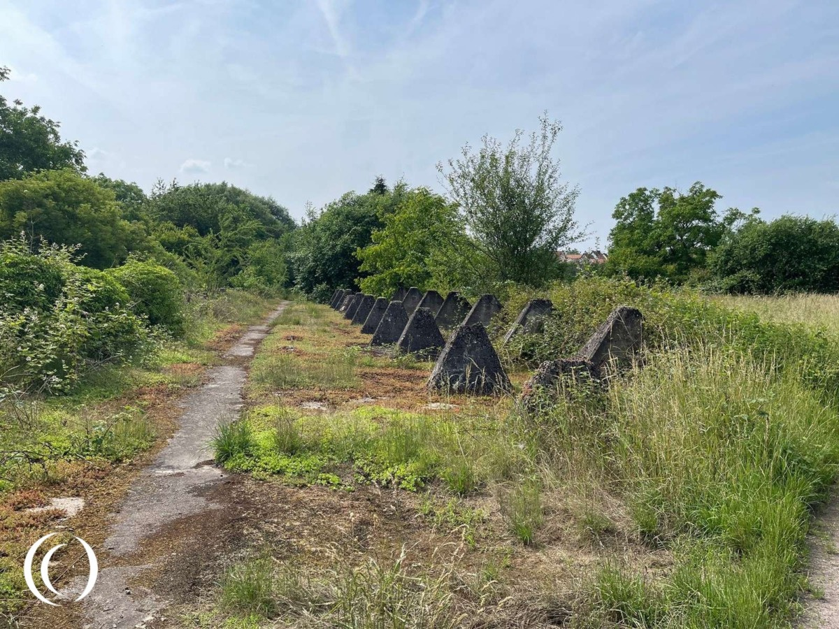
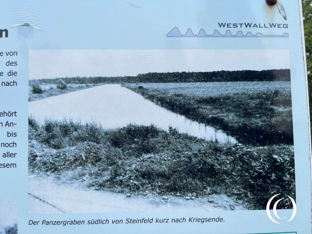
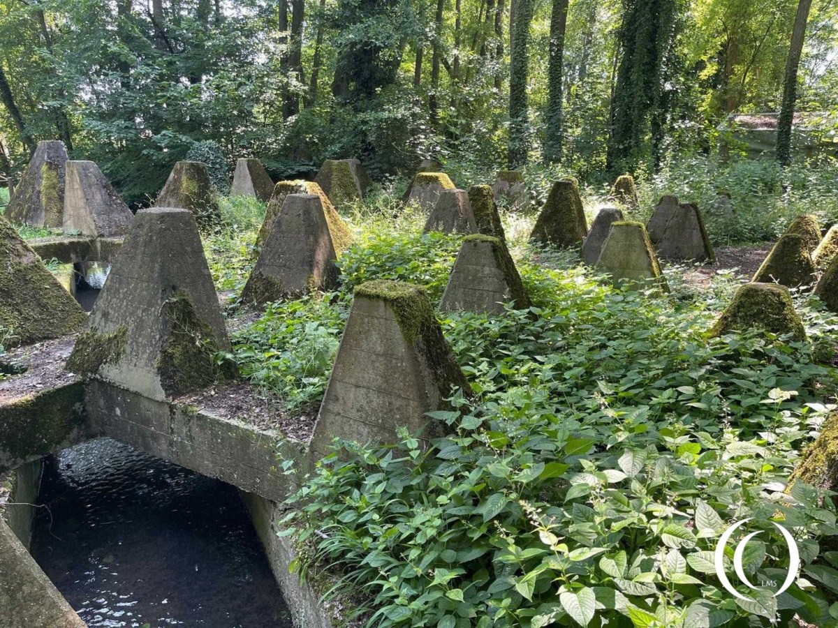
At Niederotterbach, a water‑filled tank ditch (“nasser Panzergraben”) extends approximately 1.6 km along the Otterbach stream, reaching depths of about 3.5 m. This dry moat was strategically coupled with a Höckerlinie—rows of reinforced concrete “dragon’s teeth”: pointed pyramids constructed to immobilize enemy tanks. Uniquely here, the concrete teeth span over the Otterbach watercourse, with six linked water-filled basins integrated into the line.
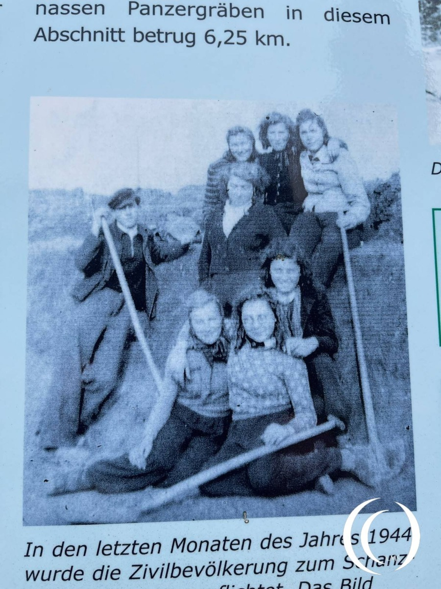
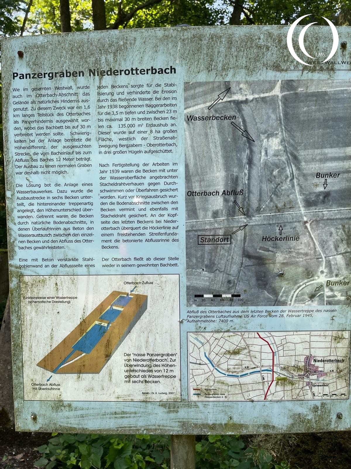
Originally part of the Aachen–Saar defensive belt built from 1938 to 1940, this installation formed part of a broader effort involving thousands of bunkers, trenches, and anti‑tank barriers across the roughly 630 km Westwall network.
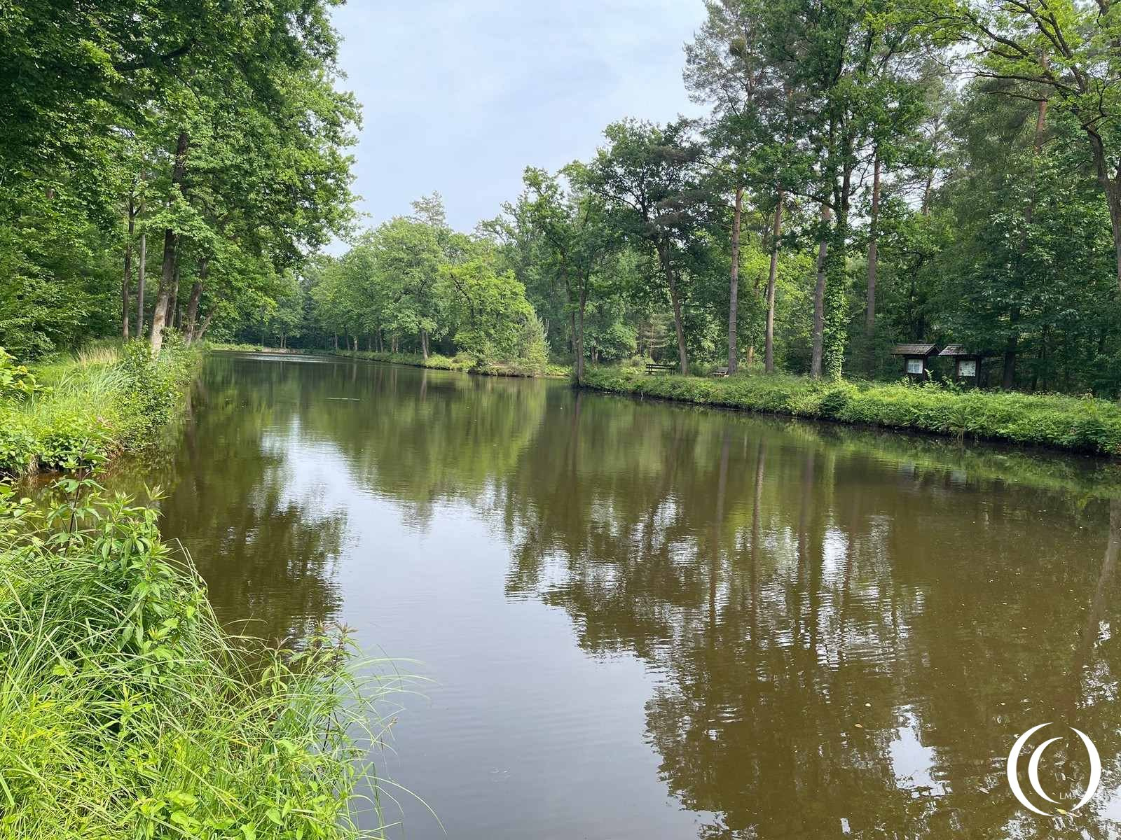
Today, the Panzergraben survives as a series of private fish ponds dotted along the former Otterbach course. Surrounding forest paths and signage allow visitors to walk the Westwall-Wanderweg, where over 30 information panels explain the historical and technical aspects of the site—intended to blend outdoor recreation with wartime heritage interpretation.
Visit
Visitors begin near Niederotterbach from the K25 road, then follow a field path a short distance to reach the preserved section of the Höckerlinie and Panzergraben. The contrast between the peaceful present landscape and the site’s historic martial engineering evokes a reflective experience.